


MINERAL POINT - T 1 Voting District, Iowa County, Wisconsin
About
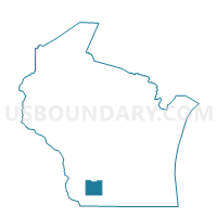
Outline

Summary
| Unique Area Identifier | 694079 |
| Name | MINERAL POINT - T 1 Voting District |
| County | Iowa County |
| State | Wisconsin |
| Area (square miles) | 40.28 |
| Land Area (square miles) | 40.19 |
| Water Area (square miles) | 0.09 |
| % of Land Area | 99.77 |
| % of Water Area | 0.23 |
| Latitude of the Internal Point | 42.84484830 |
| Longtitude of the Internal Point | -90.16811890 |
Maps


Graphs
Select a template below for downloading or customizing gragh for MINERAL POINT - T 1 Voting District, Iowa County, Wisconsin


Neighbors
Neighoring Voting District (by Name) Neighboring Voting District on the Map
- FAYETTE - T 1 Voting District, Lafayette County, WI
- KENDALL - T 1 Voting District, Lafayette County, WI
- LINDEN - T 1 Voting District, Iowa County, WI
- LINDEN - T 3 Voting District, Iowa County, WI
- Mineral Point - C 1 Voting District, Iowa County, WI
- Mineral Point - C 2 Voting District, Iowa County, WI
- Mineral Point - C 3 Voting District, Iowa County, WI
- Mineral Point - C 4 Voting District, Iowa County, WI
- MINERAL POINT - T 2 Voting District, Iowa County, WI
- WALDWICK - T 1 Voting District, Iowa County, WI
- WILLOW SPRINGS - T 1 Voting District, Lafayette County, WI
Top 10 Neighboring County Subdivision (by Population) Neighboring County Subdivision on the Map
- Mineral Point city, Iowa County, WI (2,487)
- Mineral Point town, Iowa County, WI (1,033)
- Linden town, Iowa County, WI (847)
- Willow Springs town, Lafayette County, WI (758)
- Waldwick town, Iowa County, WI (473)
- Kendall town, Lafayette County, WI (454)
- Fayette town, Lafayette County, WI (376)
Top 10 Neighboring Place (by Population) Neighboring Place on the Map
Top 10 Neighboring Unified School District (by Population) Neighboring Unified School District on the Map
- Darlington Community School District, WI (4,917)
- Mineral Point School District, WI (4,267)
- Belmont Community School District, WI (2,231)
Top 10 Neighboring State Legislative District Lower Chamber (by Population) Neighboring State Legislative District Lower Chamber on the Map
Top 10 Neighboring State Legislative District Upper Chamber (by Population) Neighboring State Legislative District Upper Chamber on the Map
Top 10 Neighboring 111th Congressional District (by Population) Neighboring 111th Congressional District on the Map
Top 10 Neighboring Census Tract (by Population) Neighboring Census Tract on the Map
- Census Tract 9505, Iowa County, WI (4,755)
- Census Tract 9702, Lafayette County, WI (3,895)
- Census Tract 9506, Iowa County, WI (3,496)
- Census Tract 9503, Iowa County, WI (3,248)
- Census Tract 9701, Lafayette County, WI (3,035)